File:EGY orthographic.svg

Size of this PNG preview of this SVG file: 550 × 550 pixels. resolutions: 240 × 240 pixels | 480 × 480 pixels | 768 × 768 pixels | 1,024 × 1,024 pixels | 2,048 × 2,048 pixels. Foforɔ
Krataa no ankasa (SVG file, nominally 550 × 550 pixels, file size: 1.35 MB)
Tɔ fa
| Ɛmu nkyerɛkyere mu |
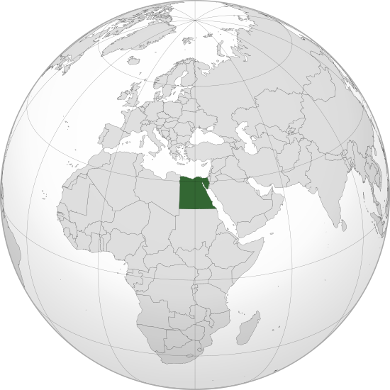
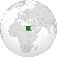
English: Orthographic map of Egypt centered at 26° N, 30º E.
Official territory.
Claimed territories. |
| Da | |
| Beaɛ a ɛfiri |
Wo ankasa w'adwuma with Natural Earth Data This W3C-unspecified vector image was created with Inkscape . |
| Ɔtwerɛfoɔ | Addicted04 |
Tumidie krataa
I, the copyright holder of this work, hereby publish it under the following license:
This file is licensed under the Creative Commons Attribution-Share Alike 3.0 Unported license.
- Wo de woho:
- sɛ wo bɛ kyɛ – to copy, distribute and transmit the work
- to remix – Ma dwumadie no mfa
- Ɛwɔ saa mbra yi ase:
- Nea ɛnam so – Ɛsɛ sɛ wo de nnidi, kyerɛ beaɛ a tumidie krataa no wɔ, na san kyerɛ sɛ nsesae bi aba mu anaa. Ɛsɛ sɛ wo kyerɛ ɛwɔ kwan pa so, na ɛmom ɛnyɛ ɔkwan a ɛkyerɛsɛ nea tumidie krataa no yɛ ne de no agye atum sɛ fa yɛ adwuma.
- share alike – If you remix, transform, or build upon the material, you must distribute your contributions under the same or compatible license as the original.
Kratafa ne ho abakɔsɛm
Mia ɛda/berɛ no so na hwɛ sɛnea krataa no baeɛ wo saa berɛ nom
| Da/Mmere | Tɔfabɔ | Akwan ahodoɔ | Odwumdini | Adwenkyerɛ | |
|---|---|---|---|---|---|
| nea ɛkɔ so | 19:26, 9 Ɛbɔ 2022 | | 550 × 550 (1.35 MB) | Salma3232 | Reverted to version as of 01:19, 11 January 2022 (UTC) |
| 17:16, 27 Kitawonsa 2022 |  | 550 × 550 (1.34 MB) | عبد العزيز علي | Reverted to version as of 23:54, 11 July 2012 (UTC) | |
| 01:19, 11 Ɔpɛpɔn 2022 |  | 550 × 550 (1.35 MB) | Бмхүн | Reverted to version as of 11:02, 7 July 2017 (UTC) | |
| 17:37, 9 Obubuo 2021 |  | 550 × 550 (1.34 MB) | Wa dou13 | Reverted to version as of 23:54, 11 July 2012 (UTC) | |
| 11:02, 7 Kitawonsa 2017 |  | 550 × 550 (1.35 MB) | Nicolay Sidorov | Kosovo, Somaliland and Northern Cyprus are not full-recognized states | |
| 23:54, 11 Kitawonsa 2012 |  | 550 × 550 (1.34 MB) | Addicted04 |
Nkrataa a wɔde di dwuma
Nea ɛdidisoɔ yi kratafa dwumadie this file:
Nea wiase nyinaa de yɛ adwuma
Wikis a edidi so yi de di dwuma:
- Yɛ de ayɛ adwuma wɔ ami.wikipedia.org
- Yɛ de ayɛ adwuma wɔ ar.wikipedia.org
- مصر
- مستخدم:جار الله/قائمة صور مقالات العلاقات الثنائية
- العلاقات الأنغولية المصرية
- العلاقات الإريترية المصرية
- العلاقات السويسرية المصرية
- العلاقات الليختنشتانية المصرية
- العلاقات البوليفية المصرية
- العلاقات المصرية الموزمبيقية
- العلاقات الألبانية المصرية
- العلاقات البلجيكية المصرية
- العلاقات البيلاروسية المصرية
- العلاقات الطاجيكستانية المصرية
- العلاقات الرومانية المصرية
- العلاقات الغامبية المصرية
- العلاقات السيراليونية المصرية
- العلاقات المصرية النيبالية
- العلاقات الليبيرية المصرية
- العلاقات التشيكية المصرية
- العلاقات المصرية الميانمارية
- العلاقات الكوستاريكية المصرية
- العلاقات الكولومبية المصرية
- العلاقات الكيريباتية المصرية
- العلاقات اللاتفية المصرية
- العلاقات اللاوسية المصرية
- العلاقات اللوكسمبورغية المصرية
- العلاقات الليتوانية المصرية
- العلاقات الليسوتوية المصرية
- العلاقات المالاوية المصرية
- العلاقات المالطية المصرية
- العلاقات المالية المصرية
- العلاقات الماليزية المصرية
- العلاقات المدغشقرية المصرية
- العلاقات المصرية الناوروية
- العلاقات المصرية الهندوراسية
- العلاقات المصرية النيكاراغوية
- العلاقات المصرية المولدوفية
- العلاقات المصرية الناميبية
- العلاقات المصرية الموريشيوسية
- العلاقات المصرية النيوزيلندية
- العلاقات المصرية الهايتية
- العلاقات المصرية الميكرونيسية
- العلاقات المصرية الموريتانية
- العلاقات الزيمبابوية المصرية
- العلاقات البالاوية المصرية
- العلاقات الفانواتية المصرية
- العلاقات الغابونية المصرية
- العلاقات البنمية المصرية
- العلاقات الجورجية المصرية
- العلاقات الأسترالية المصرية
View more global usage of this file.