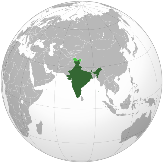
File:India (orthographic projection).svg

Size of this PNG preview of this SVG file: 541 × 541 pixels. resolutions: 240 × 240 pixels | 480 × 480 pixels | 768 × 768 pixels | 1,024 × 1,024 pixels | 2,048 × 2,048 pixels. Foforɔ
Krataa no ankasa (SVG file, nominally 541 × 541 pixels, file size: 280 KB)
Kratafa ne ho abakɔsɛm
Mia ɛda/berɛ no so na hwɛ sɛnea krataa no baeɛ wo saa berɛ nom
| Da/Mmere | Tɔfabɔ | Akwan ahodoɔ | Odwumdini | Adwenkyerɛ | |
|---|---|---|---|---|---|
| nea ɛkɔ so | 07:10, 26 Oforisuo 2023 |  | 541 × 541 (280 KB) | Swtadi143 | Reverted to version as of 07:34, 16 September 2021 (UTC) siachen glacier is fully controlled by india and not india pakistan jointly, see Siachen conflict for context. |
| 10:02, 20 Ɛbɔ 2021 |  | 512 × 512 (155 KB) | Ytpks896 | Reverted to version as of 17:38, 6 September 2021 (UTC) Siachen is a disputed territory not fully controlled by single country it is controlled by both Pakistan and india & some parts by china | |
| 07:34, 16 Ɛbɔ 2021 |  | 541 × 541 (280 KB) | Ksh.andronexus | Reverted to version as of 16:08, 19 December 2019 (UTC) | |
| 17:38, 6 Ɛbɔ 2021 |  | 512 × 512 (155 KB) | Milenioscuro | Siachen is a disputed territory between China, India and Pakistan | |
| 16:08, 19 Ɔpɛnimma 2019 |  | 541 × 541 (280 KB) | Goran tek-en | Added border for South Sudan as requested by {{u|Maphobbyist}} | |
| 14:04, 21 Ahinime 2017 |  | 541 × 541 (139 KB) | Goran tek-en | Added Siachen Glacier as requested by {{u|King Prithviraj II}} | |
| 21:31, 12 Ɛbɔ 2012 |  | 541 × 541 (167 KB) | Palosirkka | Scrubbed with http://codedread.com/scour/ | |
| 23:40, 15 Obubuo 2009 |  | 541 × 541 (573 KB) | Shibo77 | +Eritrea, Yemen; -neutral zone | |
| 13:18, 1 Obubuo 2009 |  | 541 × 541 (496 KB) | Pahari Sahib | Map showing territory governered by India, see map of Pakistan | |
| 13:17, 11 Ɔbɛnem 2009 |  | 541 × 541 (572 KB) | Tryphon | Reverted to version as of 22:12, 13 February 2009: please use the talk page before reverting this image; there are apparently many people who want the map this way. |
Nkrataa a wɔde di dwuma
Nea ɛdidisoɔ yi kratafa dwumadie this file:
Nea wiase nyinaa de yɛ adwuma
Wikis a edidi so yi de di dwuma:
- Yɛ de ayɛ adwuma wɔ ace.wikipedia.org
- Yɛ de ayɛ adwuma wɔ ady.wikipedia.org
- Yɛ de ayɛ adwuma wɔ af.wikipedia.org
- Yɛ de ayɛ adwuma wɔ ami.wikipedia.org
- Yɛ de ayɛ adwuma wɔ am.wikipedia.org
- Yɛ de ayɛ adwuma wɔ anp.wikipedia.org
- Yɛ de ayɛ adwuma wɔ an.wikipedia.org
- Yɛ de ayɛ adwuma wɔ arc.wikipedia.org
- Yɛ de ayɛ adwuma wɔ ar.wikipedia.org
- Yɛ de ayɛ adwuma wɔ ar.wiktionary.org
- Yɛ de ayɛ adwuma wɔ arz.wikipedia.org
- Yɛ de ayɛ adwuma wɔ ast.wikipedia.org
- Yɛ de ayɛ adwuma wɔ as.wikipedia.org
- Yɛ de ayɛ adwuma wɔ atj.wikipedia.org
- Yɛ de ayɛ adwuma wɔ avk.wikipedia.org
- Yɛ de ayɛ adwuma wɔ av.wikipedia.org
- Yɛ de ayɛ adwuma wɔ awa.wikipedia.org
- Yɛ de ayɛ adwuma wɔ azb.wikipedia.org
- Yɛ de ayɛ adwuma wɔ az.wikipedia.org
- Yɛ de ayɛ adwuma wɔ az.wiktionary.org
- Yɛ de ayɛ adwuma wɔ ban.wikipedia.org
- Yɛ de ayɛ adwuma wɔ bat-smg.wikipedia.org
- Yɛ de ayɛ adwuma wɔ ba.wikipedia.org
- Yɛ de ayɛ adwuma wɔ bbc.wikipedia.org
- Yɛ de ayɛ adwuma wɔ bcl.wikipedia.org
- Yɛ de ayɛ adwuma wɔ be-tarask.wikipedia.org
- Yɛ de ayɛ adwuma wɔ beta.wikiversity.org
- Yɛ de ayɛ adwuma wɔ be.wikipedia.org
- Yɛ de ayɛ adwuma wɔ bg.wikipedia.org
- Yɛ de ayɛ adwuma wɔ bh.wikipedia.org
- Yɛ de ayɛ adwuma wɔ bi.wikipedia.org
- Yɛ de ayɛ adwuma wɔ bjn.wikipedia.org
View more global usage of this file.


