File:Relief Map of Spain.png

Nea wohwɛ yi ne tibea: 699 × 600 pixels. resolutions: 280 × 240 pixels | 560 × 480 pixels | 895 × 768 pixels | 1,197 × 1,027 pixels. Foforɔ
Krataa no ankasa (1,197 × 1,027 pixels, file size: 1.9 MB, MIME type: image/png)
Tɔ fa
| Ɛmu nkyerɛkyere mu |
Deutsch: Karte Spanien
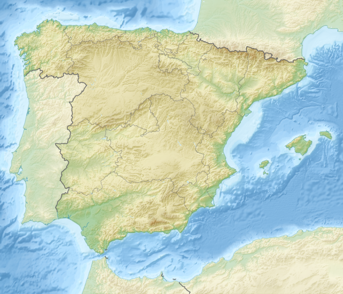
English: Map of Spain
Equirectangular projection, N/S stretching 130 %. Geographic limits of the map:
|
| Da | |
| Beaɛ a ɛfiri |
|
| Ɔtwerɛfoɔ | derivative work Виктор_В |
Tumidie krataa
This file is licensed under the Creative Commons Attribution-Share Alike 3.0 Unported license.
- Wo de woho:
- sɛ wo bɛ kyɛ – to copy, distribute and transmit the work
- to remix – Ma dwumadie no mfa
- Ɛwɔ saa mbra yi ase:
- Nea ɛnam so – Ɛsɛ sɛ wo de nnidi, kyerɛ beaɛ a tumidie krataa no wɔ, na san kyerɛ sɛ nsesae bi aba mu anaa. Ɛsɛ sɛ wo kyerɛ ɛwɔ kwan pa so, na ɛmom ɛnyɛ ɔkwan a ɛkyerɛsɛ nea tumidie krataa no yɛ ne de no agye atum sɛ fa yɛ adwuma.
- share alike – If you remix, transform, or build upon the material, you must distribute your contributions under the same or compatible license as the original.
Kratafa ne ho abakɔsɛm
Mia ɛda/berɛ no so na hwɛ sɛnea krataa no baeɛ wo saa berɛ nom
| Da/Mmere | Tɔfabɔ | Akwan ahodoɔ | Odwumdini | Adwenkyerɛ | |
|---|---|---|---|---|---|
| nea ɛkɔ so | 17:55, 28 Ɔsanaa 2010 | | 1,197 × 1,027 (1.9 MB) | Виктор В | рельеф дна |
| 11:58, 28 Ɔsanaa 2010 |  | 1,197 × 1,027 (1.53 MB) | Виктор В | == {{int:filedesc}} == {{Information |Description={{en|Location map of Spain}} Equirectangular projection, N/S stretching 130 %. Geographic limits of the map: * N: 44.4° N * S: 34.7° N * W: 9.9° W * E: 4.8° E |Source=*[[:File:Spain locat |
Nkrataa a wɔde di dwuma
Nea wiase nyinaa de yɛ adwuma
Wikis a edidi so yi de di dwuma:
- Yɛ de ayɛ adwuma wɔ als.wikipedia.org
- Yɛ de ayɛ adwuma wɔ ar.wikipedia.org
- Yɛ de ayɛ adwuma wɔ arz.wikipedia.org
- Yɛ de ayɛ adwuma wɔ as.wikipedia.org
- Yɛ de ayɛ adwuma wɔ azb.wikipedia.org
- بارسلونا
- میرامبل
- کاسکانته دل ریو
- لسکس
- منرئال دل کامپو
- کامینرئال
- منتالبان
- ال کوئربو
- کانقاس
- منریو
- بردن
- بورباقنا
- کاستیته
- مونیسا
- پنیاریا د تاستابینس
- آندرا
- لاس پاراس د کاستیته
- بلمنته د سان خسه
- بسیته
- آقوابیبا
- آرینیو
- ماس د لاس ماتاس
- یدو
- کاستلسراس
- ماسالئن
- آلبالاته دل آرسبیسپو
- لا پوئبلا د هیخار
- مسکروئلا
- منتئاقودو دل کاستییو
- اریهوئلا دل ترمدال
- کانیادا د بناتاندوس
- نقرا د آلباراسین
- لینارس د مرا
- کامارنا د لا سیرا
- وقویلس دو لا سیرا
- مسکیتا د خارکه
- لا ایقلسوئلا دل سید
- میرابته د لا سیرا
View more global usage of this file.